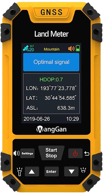
2. Click on the POWER Button on device to turn on GPS..
3. Press ENTER Button to proceed.After pressing Enter, it automatically receives signals from the satellites. Signals from minimum four satellites are required to get accurate results. Press OK to Proceed.
4. Click on the IN Button for observations. It will show the Latitude (° ‘ “),Longitude (° ‘ “) and Elevation (m) on the GPS screen. It also shows an object ID box.
5. Click on the GOTO Button to store the readings in the database.
6. Click on the CHANGE LOCATION Button to change the location.
7. Repeat Steps 6 & 7 & take seven more readings.
8. Click on the "NAVIGATION Button" to check all the readings stored or saved in the database with the help of previous & next buttons.
9. Click on the ESC Button to exit the experiment.

Powering On...
Detecting Satellites....

Longitude : 77 53 81 N
Latitude : 29 51 40 E
Elevation : 346 m
Obj. ID : Road Point A
Longitude : 77 53 69 N
Latitude : 29 51 34 E
Elevation : 334 m
Obj. ID : Road Point B
Longitude : 77 53 67 N
Latitude : 29 51 33 E
Elevation : 332 m
Obj. ID : Road Point C
Longitude : 77 53 61 N
Latitude : 29 51 30 E
Elevation : 326 m
Obj. ID : Tree Point A
Longitude : 77 53 68 N
Latitude : 29 51 34 E
Elevation : 333 m
Obj. ID : Tree Point B
Longitude : 77 53 80 N
Latitude : 29 51 40 E
Elevation : 345 m
Obj. ID : Tree Point C
Longitude : 77 53 82 N
Latitude : 29 51 41 E
Elevation : 347 m
Obj. ID : Tree Point D
Longitude : 77 53 66 N
Latitude : 29 51 33 E
Elevation : 331 m
Obj. ID : Field Point


